header image

[Sign Up Now] to Receive Our FREE Daily SCVTV-SCVNews Digest by E-Mail

Inside
Weather


Calendar
Today in
S.C.V. History
April 16
1962 - Walt Disney donates bison herd to Hart Park [story]
Bison


Commentary by Mike Summe
| Thursday, Oct 27, 2016

mikesummeWhen I moved to California in 1977, I settled in the flatlands of the L.A. basin and stayed there for the next 35 years, paying scant attention to the mountains. In 2012, I retired and started hiking and biking into the mountains that separate my home in Shadow Hills from Santa Clarita. I kept running into strange, fenced-in sites, usually located at the top of cul-de-sacs.

Each site consisted of a pit that ended at a concrete wall. Close to the wall, a strange perforated silo would rise up. On the locked gates hung two signs. One warned against trespassing. The other declared the site was under the control of the Los Angeles County Department of Public Works and gave what appeared to be the name of the site — often the name of the street followed by the abbreviation “D.B.”

It turned out that “D.B.” means “debris basin.” There are 172 in Los Angeles County, including 33 in the Santa Clarita Valley. My purpose here is to share some basic facts about these important structures and give you some leads if you’d like to do some exploration of your own.

What is a debris basin? One website (www.fws.gov) defines a debris basin as a “specially engineered and constructed basin for storing large amounts of sediment moving in an ephemeral stream channel.” The DPW provides a more helpful definition: “Debris basins are instrumental components of the flood control system. Typically located at the mouths of canyons, debris basins capture the sediment, gravel, boulders, and vegetative debris that are washed out of the canyons during storms. The debris basins capture the material and allow the water to flow into the downstream storm drain system.”

debrisbasin02Each debris basin typically consists of an excavation that begins at the bottom of a canyon and terminates at a dam. Near the dam is a “perforated silo” made of corrugated metal, sometimes concrete. The DPW calls these silos “the outlet works.” Their purpose is to allow the water to flow past (under) the dam, even when a considerable amount of debris has accumulated in the basin. The paved spillway on the downhill side of the dam helps control the water that flows under or, on occasion, over the dam.

The debris basins may also contain a number of less visible features including a porous basin that allows water to soak into the ground and a well that stores water that can later be pumped into the public water supply. In the hills above the debris basins, one may find check dams and other structures that direct water into the canyon.

Not all debris basins have all of these features; the oldest ones didn’t separate the water from the debris. As for size, most debris basins “are associated with small catchments and … are commensurately modest, with capacities under 100,000 cubic yards.” The smallest one I’ve seen is the Camp Plenty debris basin in Canyon Country; a larger, more complete one is the Wedgewood debris basin in Castaic.

What is the purpose of debris basins? The answer is best explained as the interaction of two inexorable forces. The first is the geology of Los Angeles. The mountains that dominate our landscape are among the youngest and most rapidly rising on Earth and the most unstable. As John McPhee points out in his well-known essay, “Los Angeles Against the Mountains,” the San Gabriel Mountains are “shedding, spalling” and “disintegrating at a rate that is … among the fastest in the world.” The second inexorable force is people. Los Angeles County has a population of more than 10 million, and we all know that more and more houses are being built in the mountains and foothills. There are plenty of recent examples in the Santa Clarita Valley.

What happens when these two forces interact is explained by the DPW: “Although the weather in Southern California has often been described as the best to be found anywhere, it is capricious and capable of producing enormous flood devastation. Storms, moving in from the Pacific generally from October to March, come up against the numerous steep mountain ranges that ring Malibu, the Los Angeles Basin, and the Antelope, San Fernando, San Gabriel and Santa Clarita Valleys. These storms frequently produce enormous amounts of runoff that spill out onto the flatlands leading to the Pacific Ocean or Mojave Desert. And if the age-old fire sequence has occurred along the hillsides during the dry months, the rate, composition and amount of runoff are substantially increased. Since the geological composition of the mountain ranges erodes quite easily, a heavy mix of debris is added to the descending storm waters.”

John McPhee gives a vivid description of what the DPW calls “a heavy mix of debris.” Debris flows, McPhee explains, “more or less resemble fresh concrete. They consist of water mixed with a good deal of solid material, most of which is above sand size. Some of it is Chevrolet size.” His automotive metaphor is not inappropriate, for in his description of a specific event, he tells how a mudslide “was not only full of boulders; it was so full of automobiles it was like bread dough mixed with raisins.” Making matters worse, the mudslide was fast enough to overtake a number of residents who tried to flee downhill in their cars.

How effective are the debris basins? Although man cannot control the mountains of Los Angeles, John McPhee admits: “Generally, the debris basins work.” But they are not 100 percent effective, and debris basins can and have been overwhelmed – sometimes with catastrophic results. Also, debris basins are expensive – not only to build, but also to maintain.

debrisbasin01To function properly, the debris must regularly be cleaned out, which not only requires expensive contracts, but also raises the question of where the debris goes. It is easiest if the site is nearby, but you probably won’t be surprised to learn this is not always popular with residents. Sometimes the debris, which in the absence of man’s intervention would have washed down to the ocean, is hauled in the opposite direction over the mountains. McPhee explains the irony: “Now there is a beach problem. Sand is being lost to offshore canyons and is not being replenished. … A place that values its beaches as much as Southern California does has no choice but to buy sand.” And people can be picky. “When 30,000 yards of sand was put on Zuma Beach, people complained that it was the wrong color.”

A short history. In the early days, “there was a moat of oranges between the built-up metropolis and the mountain front.” However, when wildfires in late 1913 were followed by heavy rains and a flood in early 1914, it was clear that more protection was needed. The government responded quickly. In 1915, the California Legislature created the Los Angeles County Flood Control District. One of its first projects was the Devil’s Gate Dam, built in 1920 to control the Arroyo Seco. A few years later, nature again delivered its one-two combination. At the end of 1933, wildfires denuded the slopes above Pasadena, La Cañada, La Crescenta and Montrose. Then on New Year’s Day, a “Noah-type storm” struck, mobilizing “a number of almost simultaneous debris flows that came out of the mountains, went through the orchards and into the towns, killed dozens of people, destroyed hundreds of houses, and left boulders the size of icebergs.”

There was ironically an unexpected benefit to this disaster. People noticed that a gravel pit in Haines Canyon above the village of Tujunga had swallowed the debris flow that would otherwise have wiped out the community. According to McPhee, this gravel pit became the inspiration, the model for all debris basins.

Be that as it may, a number of debris basins were built on the southern slopes of the San Gabriels in the aftermath of the 1934 mudslides. On a website maintained by the U.S. Geological Survey, I found the dates of initial operation for 75 of Los Angeles County’s 172 debris basins. Fifteen were built in the immediate aftermath of the 1934 flood, all in the area of that flood. Seven more were built in the 1940s; again, most were built on the south-facing slopes of the San Gabriels in the greater Pasadena area, but one was built as far west as Northridge and another as far east as Brea. Nineteen were built in the 1950s, with most on the south-facing slopes above Foothill Boulevard, but with one in Whittier, one in the Verdugos and a few in the San Fernando Valley. Twenty were added in the 1960s, some in the core area but others extending out to Glendora and one in Newhall — the Wildwood debris basin on Davey Avenue. The USGS website identified 12 debris basins built between 1970 and 1975; however, there was no information for subsequent years, so I do not have operation start dates for the other 97 debris basins.

My guess is that the 97 undated debris basins were built after 1975. Why do I say this? Because the information I do have suggests the building of debris basins occurred in step with the development of housing tracts in or near the mountains. My sense is that the earliest residential development occurred in the greater Pasadena area where the earliest debris basins are located. It also seems that the order in which additional debris basins radiated from Pasadena between 1940 and 1975 follows the same timeline as residential expansion. Many of the undated debris basins are located in areas where large-scale building occurred still later.

To the east, the communities with debris basins for which I have no dates include Monrovia, Duarte, Glendora, Rowland Heights, Diamond Bar; to the west, Canoga Park, Calabasas, Malibu; and to the north, Santa Clarita, Castaic and Palmdale.

As part of my research, I visited five debris basins in the hills along Hillcrest Parkway in Castaic. The neighborhoods are obviously newly built, and at the end of the cul-de-sacs that mark the uphill limit of development, I found the debris basins. My conclusion? They were built contemporaneously with the housing tracts. Am I right? I won’t know for sure until I find the start dates. If anyone can provide me with such dates or point me in the right direction, please send me the information.


Mike Summe is a docent at the Placerita Canyon Nature Center and a retired high school principal.

Comment On This Story
COMMENT POLICY: We welcome comments from individuals and businesses. All comments are moderated. Comments are subject to rejection if they are vulgar, combative, or in poor taste.
REAL NAMES ONLY: All posters must use their real individual or business name. This applies equally to Twitter account holders who use a nickname.

4 Comments

  1. Very interesting Mike. Thanks.

  2. Julio Diaz Julio Diaz says:

    Fantastic read, thank you Mike :)

  3. Great, Mike. Tried to share this in Placerita fb page, failed.

  4. Tina White Tina White says:

    I talk about these in the college geography courses I teach; thank you for an interesting new assigned reading for my students!

Leave a Comment


Opinion Section Policy
All opinions and ideas are welcome. Factually inaccurate, libelous, defamatory, profane or hateful statements are not. Your words must be your own. All commentary is subject to editing for legibility. There is no length limit, but the shorter, the better the odds of people reading it. "Local" SCV-related topics are preferred. Send commentary to: LETTERS (at) SCVNEWS.COM. Author's full name, community name, phone number and e-mail address are required. Phone numbers and e-mail addresses are not published except at author's request. Acknowledgment of submission does not guarantee publication.
Read More From...
RECENT COMMENTARY
Monday, Apr 15, 2024
Cowboy Festival weekend is upon us!
Thursday, Apr 11, 2024
Have you ever wanted to journey to another country to experience an array of new and unique cultures and customs?
Tuesday, Apr 9, 2024
In bustling Santa Clarita, where many residents lead busy lives and often feel divided and disconnected, there is a growing need for spaces that bring people together, fostering community and hope.
Monday, Apr 8, 2024
Each spring the city of Santa Clarita proudly showcases its cowboy culture and pays homage to its rich Western heritage during the one-of-a-kind Santa Clarita Cowboy Festival.
Thursday, Apr 4, 2024
Springtime, with all its blossoms and lovely weather is a popular time to get married. If you are looking to say “I do” at this picturesque time of year, look no further than City Hall Ceremonies.
Wednesday, Apr 3, 2024
It is anticipated that the three bylaw changes proposed by the CIF Sports Medicine Advisory Committee will pass this coming Friday, April 5 at the State CIF Federated Council meeting.

Latest Additions to SCVNews.com
1962 - Walt Disney donates bison herd to Hart Park [story]
Bison
The U.S. Court of Appeals for the 9th Circuit affirmed a $68.5 million judgment Monday for SCV Water for the cleanup of local groundwater contamination in its case against the Whittaker Corporation.
Federal Appeals Court Upholds SCV Water Judgment Against Whittaker
Angelo Aleman smacked a pair of home runs as College of the Canyons concluded its three-game series vs. Antelope Valley College with a 10-5 home victory at Mike Gillespie Field on Friday. 
Cougars Defeat Antelope Valley College 10-5
Castaic Union School District is thrilled to announce that Lara Frandzel has been selected to participate in the Teacher Innovator Institute at the Smithsonian’s National Air and Space Museum in Washington, D.C
Castaic Educator Selected for Smithsonian’s Teacher Innovator Institute
The city of Santa Clarita’s exciting Concerts in the Park series, presented by Logix Federal Credit Union, makes its highly anticipated return this summer for friends, families and neighbors to gather under the evening sky and enjoy free, live musical performances on Saturdays from July 6 to Aug. 24, at Central Park, located at 27150 Bouquet Canyon Road.
City Releases 2024 Concerts in the Park Lineup
The Master's University men's volleyball team left no doubt about it as they swept the OUAZ Spirit 25-22, 25-14, 25-22 in the season finale Saturday in The MacArthur Center.
Mustangs Capture First GSAC Season Title
Join the Greater Los Angeles County Vector Control District online for an engaging conversation with experts in the field as they discuss the latest advancements and future trends in vector control Monday, April 15, from 6 p.m to 7:30 p.m.
Register Now for Greater L.A. County Vector Control Fireside Chat
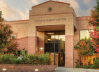
In recognition of Mental Health Awareness Month in May, Child & Family Center is presenting a series of four seminars for parents and caregivers of children and teens.
Child & Family Center Offering Mental Health Seminar Series
The University Student Union at California State University, Northridge is helping Matadors keep their peace during finals season with Crunch Time.
Matadors Gearing Up for Finals at CSUN’s ‘Crunch Time’
The Los Angeles County Department of Public Health has been notified by the California Department of Public Health of one case of measles in a non-Los Angeles County resident who traveled throughout Los Angeles County from Saturday, March 30 to Sunday, April 1.
L.A. County Sites Identified for Possible Measles Exposure
California Department of Transportation, along with Valencia-based C.A. Rasmussen, continues to make progress on the Wallis Annenberg Wildlife Crossing.
Wildlife Crossing Construction Prompts 101 Overnight Closures
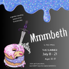
The Santa Clarita Shakespeare Festival is expanding its 2024 Summer Season to include a weekend of performances at the MAIN in July by members of this summer’s youth Shakespeare Camp.
Youth Show Added to Santa Clarita Shakespeare Festival
The 28th Santa Clarita Cowboy Festival makes its anticipated return to William S. Hart Park, located at 24141 Newhall Avenue, this upcoming weekend!
City Announces Cowboy Festival Road Closures
With the federal and state deadlines for filing and paying taxes approaching in three days, Los Angeles County is also renewing its focus on taxes, with a special focus on enhancing its property tax correction and reimbursement processes.
L.A. County Aims to Speed Up Property Tax Corrections
The Los Angeles County Development Authority will be accepting registrants for its Senior and Family Public Housing Site-Based Waiting Lists, including Orchard Arms Senior Apartments in Valencia, from April 15, 8 a.m. through April 30, 11:59 p.m., or until a sufficient number of registrations have been received, whichever occurs first.
Orchard Arms Senior Housing Waitlist Now Open
Live jazz music, entertainment by talented William S. Hart Union High School District Students, music by Lance Allyn, be treated to happy hour, plus six seated courses - each one created by a different chef from your favorite local restaurants and paired with fabulous wines, local and statewide.
Wine on the Roof Tickets Still Available
Local realtor, Racquel Wilder, is hosting a free community paper shredding event Sunday, April 21, from 12 p.m. to 3 p.m., in the parking lot of Congregation Beth Shalom.
April 21: Free Community Paper Shredding Event
1954 - Frank Sinatra, Sterling Hayden on streets of Newhall for filming of "Suddenly" [story]
Frank Sinatra
2014 - "Become Ocean" by John Luther Adams (CalArts BFA 1973) named winner of 2014 Pulitzer Prize in Music [story]
John Luther Adams
A special meeting of the William S. Hart Union High School District’s Governing Board will be held 4:30 p.m. Wednesday, April 17. It will be followed by the regular meeting of the Hart Board at 7 p.m.
April 17: Hart District to Choose Search Firm, Offer Hart Mascot Presentation
1935 - Gladys Carter convicted of manslaughter in fatal shooting of Frances Walker, of the Placerita Walkers [story]
Gladys Carter
The Santa Clarita Planning Commission will hold its regular meeting Tuesday, April 16, at 6 p.m. in City Council Chambers at City Hall, 23920 Valencia Blvd. 1st Floor, Santa Clarita, CA 91355.
April 16: Planning Commission to Discuss Town Center Specific Plan
Hundreds of residents joined the Santa Clarita City Council and dignitaries on Saturday, Aprl 6, for the grand opening of the city’s newest amenity, Skyline Ranch Park. Marking the 38th park in the community, the 10.5-acre park offers activities for everyone.
Santa Clarita Opens 38th Park, Skyline Ranch Park
SCVNews.com