[NWS] – A dramatic change in the weather is expected the second half of the week as a pair of winter storms are forecast to move across southwestern California. These two storms will bring significant rainfall, high-elevation snow and gusty winds.
The first storm is expected to impact the area Wednesday and Wednesday night. Rain will begin across San Luis Obispo and Santa Barbara counties Wednesday afternoon and will spread south and east into Ventura and Los Angeles counties Wednesday evening before exiting the region Thursday morning, with a shower threat lingering over the mountains Thursday afternoon.
 For Ventura and Los Angeles counties, generally one-quarter inch or less is expected, with locally higher amounts in favored upslope areas. Snow levels will remain relatively high, above 7,000 feet during the day on Wednesday, then dropping to around 6,000 feet Wednesday night and Thursday. Along with the precipitation, gusty south to southwest winds are expected.
The second storm will impact the area Friday and Saturday and will likely be the strongest storm the area has experienced in quite some time.
Moderate to heavy rain is expected to move into San Luis Obispo and Santa Barbara counties Friday morning, then will spread into Ventura and Los Angeles counties Friday afternoon and evening before exiting Saturday morning.
However, behind the system, widespread shower activity is likely through Saturday. Rainfall amounts with this storm could be impressive. Early estimates are for 1 to 2 inches for coastal and valley areas with 2 to 4 inches in the foothills and mountains, with even higher amounts possible along south-facing slopes.
Additionally, the conditions could be favorable for thunderstorm development, which would bring intense rainfall over a short time period.
Snow levels on Friday will generally be above 7,000 feet but will drop to around 5,000 feet by Saturday, so the mountains could receive some significant snowfall and winter storm conditions due to strong and gusty south to southwest winds.
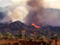
One area of special concern with the second storm will be the potential for mud and debris flows. Given the potential for heavy and intense rainfall, residents in areas near the recent burn areas will need to stay alert for potential mud and debris flow issues.
Like this:
Like Loading...
Related


 Tweet This
 Facebook
 Digg This
 Bookmark
 Stumble
 RSS
RSS


REAL NAMES ONLY: All posters must use their real individual or business name. This applies equally to Twitter account holders who use a nickname.
24 Comments
Let’s hope!
Yay!
We’ll take it!
Yay!!! It cracks me up though you say significant rain! We need to get about 50 inches a season to help our water situation in this state
Yay! Some good news that actually makes sense!
Yay!!
Better than 4 feet of snow!
I’ll believe it when I see it!! Palmdale here… We rarely get it even when they predict it!
‘Bout time!
Let it rain. Not all at once but let it rain
YESS!!
Welcome to my world!!!
Is about time!!!!!!!!!!!!!!!!!!!!!!!!!! :)
Get the row boats out!
Wahoo! Bring it on!
:)))))))))))))
i guess we are officially on “storm watch”:) can’t wait to see the newscasters in gorman!
take cover sisty of mine
We need the rain!
Finally some much needed rain!!
Yay! We need it!
Yay! We need it!
Praying the rain will fall!
Yeah….