|
|

|
|
|
[Sign Up Now] to Receive Our FREE Daily SCVTV-SCVNews Digest by E-Mail |
|
|
Inside Weather
Calendar 
Today in S.C.V. History April 19
|
Comment On This Story |
Opinion Section Policy
Read More From... RECENT COMMENTARY
Tuesday, Apr 16, 2024
Monday, Apr 15, 2024
Thursday, Apr 11, 2024
Tuesday, Apr 9, 2024
Monday, Apr 8, 2024
Thursday, Apr 4, 2024
|


 Tweet This
 Facebook
 Digg This
 Bookmark
 Stumble
 RSS
RSS


Latest Additions to SCVNews.com
|
Hello Auto Group has announced its partnership with the Santa Clarita Veteran Services Collaborative for the second annual Military Spouse Appreciation Event. This event, dedicated to honoring military spouses, will take place on Military Spouse Appreciation Day Friday, May 10, from 10 a.m. to 2 p.m. at the Anthony Vince Nail Spa at 24250 Town Center Drive #140, Valencia, CA 91355.
 |
The Santa Clarita Artists Association has announced the 2024 scholarship award recipients. These deserving individuals have shown excellence in their high school art education and shared their plans to continue their artistic endeavors.
 |
The Valley Industry Association of Santa Clarita is set to ignite innovation and transformation with its VIA Workforce Development Conference 2024 at the Hyatt Regency Valencia on Thursday, May 16. Jorge Marquez, chairman of the Los Angeles County Workforce Development Board, has been added to the list of speakers appearing at the event. He will serve as the opening speaker at the conference.
 |
The city of Santaw Clarita will host the Free To Be Me Festival for its third year at an exciting new location. On Sunday, May 5, from noon to 3 p.m., celebrate Santa Clarita’s special needs communities and their families at West Creek Park, 24247 Village Circle Drive, Valencia, CA 91354.
 |
The Los Angeles County Department of Economic Opportunity and its regional partners have held the first of several upcoming rapid response events to urgently connect soon-to-be laid off local workers, impacted by the recent bankruptcy and closure of dozens of local 99 Cents Only Stores, to critical workforce services.
 |
Youth in Los Angeles County foster care as young as 13 can open their own checking and savings accounts without an adult co-owner through the Youth Access Banking program.
 |
|
The Santa Clarita City Council will hold a regular meeting on Tuesday, April 23 at 6 p.m. The council will meet at City Hall, City Council Chambers, Items on the agenda include: Measure H funding, awarding construction contracts for traffic improvements and updating criteria for speed hump installation or removal.
 |
Visit Vasquez Rock Natural Area and Nature Center for a Day at The Rocks, a family fun event and tribal celebration of the Village of Mapipinga. A Day at The Rocks will be held Saturday, April 27 from 10 a.m. to 2 p.m.
 |
Princess Cruises, headquartered in Valencia, and ship builder Fincantieri of Monfalcone, Italy have announced the mutual decision to postpone the delivery of the next Sphere Class ship, Star Princess.
 |
|
The Master's University men's golf team shot a 13-under 275 to finish second at the Golden State Athletic Conference Men's Golf Championships held at Briarwood Country Club in Sun City West, Ariz.
 |
Join local nonprofit Project Sebastian for an exhilarating day of racing and community support at its Rare Warrior 24 race on Saturday, June 1, at Heritage Park in the heart of Santa Clarita.
 |
|
Santa Clarita Valley Sheriff's Station Station deputies will be taking part in the “DEA National Drug Take Back Day,” Saturday, April 27, from 10 a.m. to 2 p.m., in front of the SCV Sheriff’s Station, located at 26201 Golden Valley Road.
 |
The College of the Canyons Center for Civic and Community Engagement—in collaboration with COC’s Golden Z Club—invites the community to attend the Nonprofit Community Resource Fair on Tuesday, April 30.
 |
College of the Canyons made quick work of visiting L.A. Valley College in a shortened 11-3 home victory that came on a day in which the program unveiled its newly named Michele Jenkins Softball Team Room during a pre-game dedication ceremony.
 |
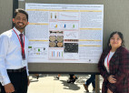
For aspiring scientists at The Master’s University, taking up a student research project is no small commitment.
 |
The Los Angeles County Department of Public Health is warning residents not to use a Vietnamese herbal ointment called “Cao Bôi Trĩ Cây Thầu Dầu” (Castor Oil Hemorrhoid Extract) because it contains lead and can be fatal.
 |
State Superintendent of Public Instruction Tony Thurmond hosted a California Apprenticeship Summit Wednesday to raise awareness of apprenticeship opportunities and career technical education pathways that connect California’s youth to high-wage, high-growth career opportunities.
 |
|
College of the Canyons student-athletes Nichole Muro (softball) and Angelo Aleman (baseball) have been named the COC Athletic Department's Women's and Men's Student-Athletes of the Week for the period running April 8-13.
 |
California State Sen. Scott Wilk, R-Santa Clarita, announced Wednesday his bill improving transparency between parents and schools’ sexual education curricula passed out of the Senate Education Committee.
 |
|
The 76.6-mile-long Antelope Valley Line has the third-highest ridership in Metrolink’s system with an estimated average of 9,000 passengers daily. However, the uneven terrain and single-tracking along the line in some areas forces trains to travel at a slower speed which results in an estimated travel time of approximately one hour between Santa Clarita and Union Station.
 |
Team Dragon Eyes, affectionately known as TDE, is gearing up to host its highly anticipated Fifth Annual Dragonboat Festival race on Saturday, June 1 at Castaic Lake, Lower Lagoon.
 |
This year marks the 20th year that the city of Santa Clarita has been hosting the annual Bike to Work Challenge. The community is invited to celebrate by riding a bike to work the week of May 13, and stopping by a pit stop on Thursday, May 16.
 |

REAL NAMES ONLY: All posters must use their real individual or business name. This applies equally to Twitter account holders who use a nickname.
8 Comments
I really enjoyed this story Dianne. Thanks for sharing!
Thanks so much – I really enjoyed this great article, and your inclusion of other sources led me to do further (and fascinating)research for several hours this Easter morning. I really appreciate the effort you put into this!
I love learning about abandoned things like this. Is there a history company our gruop that offers tours?
April
How do I find out how to do this sounds awesome
Following
Pretty cool
Great story! Fascinating bit of local history.