The National Weather Service has issued a “Hazardous Weather” warning for the Santa Clarita Valley and Southern California.
Flood Watch in effect from Dec. 23, 4 p.m. PST until Dec. 25, 10 p.m. PST.
High Wind Warning until Dec. 25, 3 p.m. PST.
A flood watch, with potentially life-threatening flooding, remains in effect from the afternoon of Tuesday, Dec. 23-Thursday, Dec. 25 for all areas of San Luis Obispo, Santa Barbara, Ventura and Los Angeles counties.
Significant and widespread flooding caused by excessive rainfall will be likely, with potential debris flow impacts across recent burn scars.
This prolonged strong Atmospheric River storm system will bring periods of heavy rain from late Tuesday into Thursday evening. Potential flooding impacts include the threat of significant and widespread urban roadway flooding, a high risk of major rock/mudslides, and rapid rises in creeks, streams and rivers which will likely lead to swift water rescues.
The recent burn scars will be at risk for debris flows, possibly damaging.
These flooding impacts will likely lead to significant travel delays and road closures during this busy holiday travel period.
Heavy rainfall with possible thunderstorms is expected with high rainfall rates, potentially exceeding one inch per hour during the peak of the event Tuesday night into Wednesday across favored south facing slopes and near thunderstorms.
Another round of heavier rain and thunderstorms will be possible on Thursday.
For information on how to keep safe visit www.weather.gov/safety/flood.
You should monitor later forecasts and be alert for possible Flood Warnings. Those living in areas prone to flooding should be prepared to take action should flooding develop.
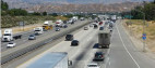
High windes are forcast for Catalina and Santa Barbara Islands, Santa Clarita Valley, Western Santa Monica Mountains Recreational Area, Eastern Santa Monica Mountains Recreational Area, San Miguel and Santa Rosa Islands, Santa Cruz and Anacapa Islands including the cities of Avalon, Santa Clarita, Malibu Bowl, Topanga, Cuyler Harbor, Smugglers Cove, Valencia, Lake Castaic and Newhall.
High wind warning is in effect from noon Tuesday, Dec. 23 to 3 p.m. Thursday, Dec. 25.
South to southeast winds 25 to 40 mph with damaging gusts up to 60 mph likely.
From noon Tuesday to 3 PM PST Thursday. Winds to peak in most areas Tuesday night into Wednesday.
Damaging winds are likely with this powerful Atmospheric River storm, with widespread downed trees and powerlines likely, as well as the potential for power outages and property damage.
Travel will be difficult, especially for high profile vehicles.
The combination of strong winds and moist soils will increase the risk for downed trees.
Remain in the lower levels of your home during the windstorm and avoid windows. Watch for falling debris and tree limbs. Use caution if you must drive.
For more information and updated forecasts visit https://forecast.weather.gov/.

Like this:
Like Loading...
Related


 Tweet This
 Facebook
 Digg This
 Bookmark
 Stumble
 RSS
RSS


REAL NAMES ONLY: All posters must use their real individual or business name. This applies equally to Twitter account holders who use a nickname.
0 Comments
You can be the first one to leave a comment.