The city of Santa Clarita prioritizes public safety and was recently honored with a Certificate of Recognition by the California Emergency Services Association Southern Chapter, or CESA-SC, for the development and implementation of the city’s Emergency Trails Locator System.
The system was launched earlier in 2019 and provides a quick and easy way for trail users in Santa Clarita to convey their location to first responders in an emergency.
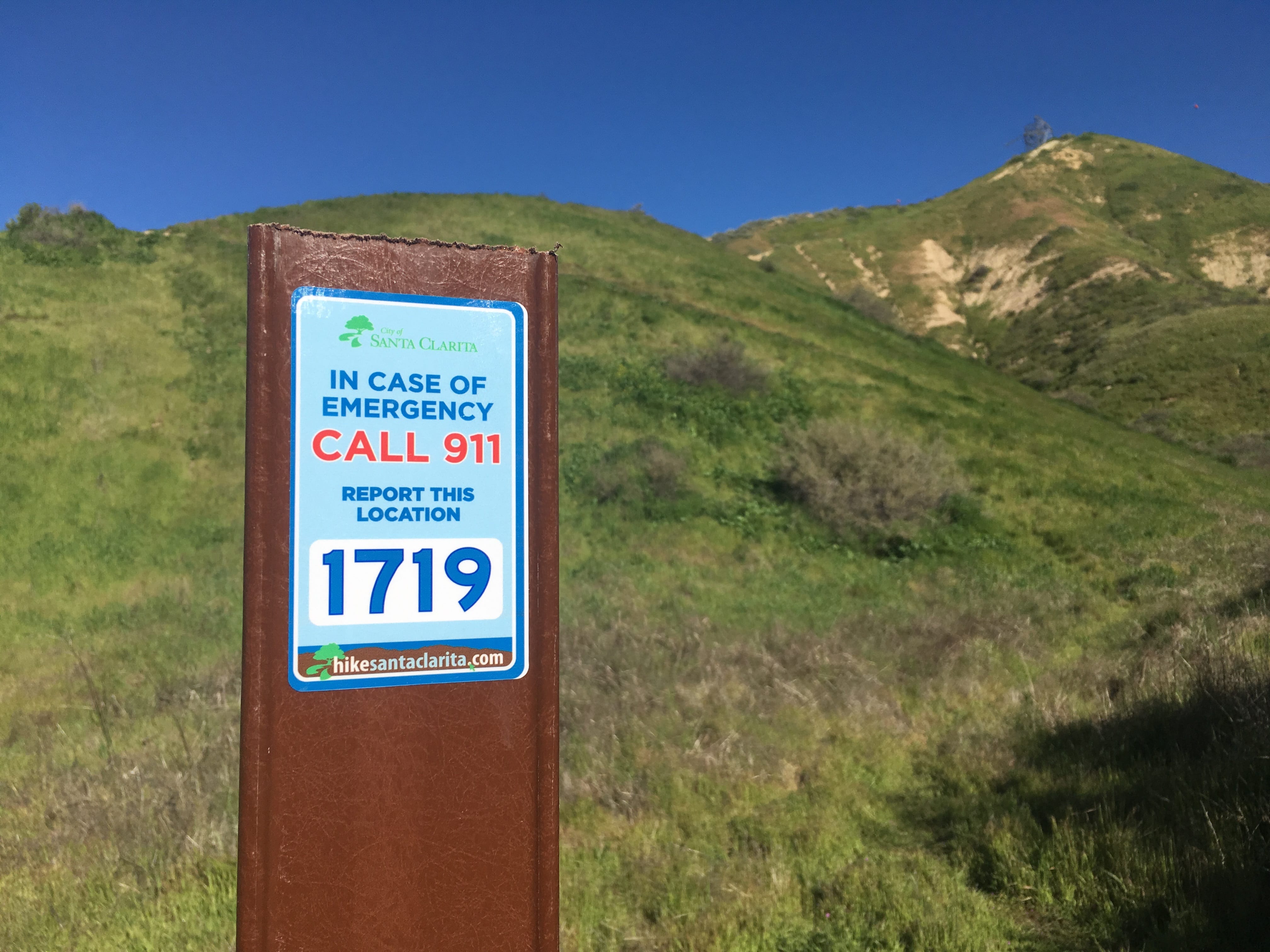
As part of the system, a total of 658 markers were installed every 1/8 mile on all city trails, including bike paths and hiking trails.
“The thousands of acres of open space and nearly 90 miles of off-street trails provide residents with unparalleled amenities. The Emergency Trails Locator System gives added peace of mind and enhances safety and security for residents and visitors alike,” said Jeff Morrison, the city’s project development coordinator for this project.
Each marker is assigned a number, which designates its exact location. The numbers correspond to a geographic information system map that has been provided to local first responders. In an emergency, trail users can dial 911 and provide the number of the nearest locator, which can then be used to pinpoint their location for a faster and more efficient response.
For more information about the Emergency Trails Locator System, visit santa-clarita.com/emergencylocator or email gis@santa-clarita.com.
Like this:
Like Loading...
Related


 Tweet This
 Facebook
 Digg This
 Bookmark
 Stumble
 RSS
RSS


REAL NAMES ONLY: All posters must use their real individual or business name. This applies equally to Twitter account holders who use a nickname.
0 Comments
You can be the first one to leave a comment.