SACRAMENTO – Yo-yoing between heat waves, torrential rainfall and raging wildfires that burn through Thanksgiving, the explosive nature of California’s weather has been on full display over the last several years, and state water experts are calling for an update to water plans for extreme weather.
The state’s worst drought, one of its wettest winters and both the largest and most destructive wildfires all occurred this decade.
Unpredictability has long been a staple of the Golden State’s climate, but scientists warn that warming temperatures will likely lead to shorter, more intense rainy stretches – putting added strain on the state’s overworked water infrastructure.
Casting climate change as a direct threat to California’s water security, a panel of experts on Tuesday said the state must develop water plans for the “new normal” by modernizing water infrastructure before the next great disaster.
“The volatility just makes it harder to use our multipurpose reservoirs,” said Ellen Hanak, director of the Public Policy Institute of California Water Policy Center. “When you’ve got higher, spikier runoff, that means you have higher flood risk at the same time you want to be saving water for drought.”
As is the case across the country, California’s major dams and reservoirs were built decades ago and designed to supply fewer people and protect against a smaller flood risk.
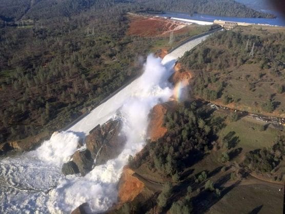
Facing runoff from a series of major winter storms, California narrowly escaped an unimaginable disaster in February 2017 when the spillway at the nation’s tallest dam disintegrated and sent nearly 200,000 Northern Californians scrambling. A break in the weather helped state officials eventually gain control of the situation, but it was a wakeup call and repairs ultimately cost taxpayers more than $1 billion.
The near catastrophe at Oroville Dam would have rivaled any disaster in state history, leaving millions homeless and without water from Northern California to Los Angeles.

A panel discusses the Public Policy Institute of California’s water plan in Sacramento on Nov. 5, 2019. | Photo: Nick Cahill / CNS.
Though the dam is once again in working condition, experts who participated in the PPIC’s water forum Tuesday said other repairs are needed to prepare California for the next big storm. The nonpartisan think tank suggests not just fixing old dams and sinking canals, but diversifying the water grid by creating ways to capture runoff during floods and use it to recharge aquifers.
The PPIC’s 20-page report explores how five effects of climate change – warming temperatures, shrinking snowpack, shorter and more intense rainy seasons, volatile precipitation and rising seas – will impact the state’s ability to get water to a growing population of 40 million.
No region has felt the sting of California’s changing climate more than sparsely populated Lake County, located on the outskirts of the state’s famous wine country.
The county that was once occupied by Pomo Native Americans, who hunted in the rolling foothills and fished in Clear Lake for centuries, has been in some official state of emergency for the last eight years. The estimated 65,000 county residents have lived through nearly every sort of natural disaster imaginable, says Lake County administrator Jan Coppinger.
“It started with the drought which of course brought on millions of dead trees and led to massive wildfires,” Coppinger told the crowd in downtown Sacramento. “Over 60% of our county has burned; we’ve lost thousands of homes and water systems even burned down.”
Storms that finally moved in from the Pacific Ocean in 2017 may have tamped down drought conditions in Lake County, but they also sent a rush of mud and debris through burn scars and into neighborhoods. The scenario was replayed this past winter as well.
“If you’ve lived in California over the 10 years, this has been your life,” said PPIC researcher Van Butsic of the alternating disasters.
While also prone to wildfires and earthquakes, floods are perhaps the largest hazard facing California’s Central Valley.
State, local and federal government water plans have largely been able to protect the agricultural heartland over the last 100 years, but the risk remains for the over 6 million people now living in the basin.
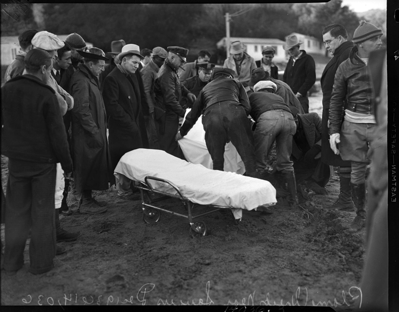
The last major flood to hit the region was in January 1997, when the San Joaquin River and its tributaries jumped their banks and levees after a series of atmospheric rivers hit California. The rivers breached levees and several reservoirs spilled over, flooding 250 square miles and over 20,000 homes in the valley.
Tim Ramirez, member of the Central Valley Flood Protection Board, says not enough has been done to shield the valley from another major flood. He added the major flood infrastructure from 1997 remains in place while the region’s population has boomed.
“There’s not a lot that’s different from 22 years ago,” Ramirez contends. “When this event happens, we’re going to have all the same problems.”
In the short term, Ramirez recommends that state and local agencies update evacuation plans and warning systems before the next flood hits. In the long term, dedicating more land to send water from the San Joaquin River and its tributaries during floods could alleviate pressure on dams and levees.
The report, issued before the Legislature resumes in January, calls for the creation of new incentives to spur water districts into implementing flexible management systems and make it easier for them to do things like trade water.
“The state can encourage improved cooperation and alignment among local jurisdictions, which make most frontline management decisions and are often leading innovation,” the water plans states.
— By Nick Cahill
Like this:
Like Loading...
Related


 Tweet This
 Facebook
 Digg This
 Bookmark
 Stumble
 RSS
RSS


REAL NAMES ONLY: All posters must use their real individual or business name. This applies equally to Twitter account holders who use a nickname.
0 Comments
You can be the first one to leave a comment.