|
|

|
|
|
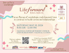
[Sign Up Now] to Receive Our FREE Daily SCVTV-SCVNews Digest by E-Mail |
|
|
Inside Weather
Calendar 
Today in S.C.V. History May 7
1861 - Andres Pico and partners granted state franchise to build toll road and cut 50-foot-deep cleft through (Newhall) Pass; they failed; Beale later succeeded [story]
|
Comment On This Story |
LATEST CITY HEADLINES
Monday, May 6, 2024
Monday, May 6, 2024
Monday, May 6, 2024
Friday, May 3, 2024
Friday, May 3, 2024
Keep Up With Our Facebook
|


 Tweet This
 Facebook
 Digg This
 Bookmark
 Stumble
 RSS
RSS


|
Latest Additions to SCVNews.com
|


REAL NAMES ONLY: All posters must use their real individual or business name. This applies equally to Twitter account holders who use a nickname.
3 Comments
Well, thank you for warning us, SCVNews. A month’s worth of traffic jams on a major North-South artery is a big deal in this big little town. Of course, the City could have taken a hint from the CalTrans work on the 14 and made the contractor work from 7pm to 5am instead of this traffic-screwing program that only allows one-lane traffic in each direction during the heaviest travel time on that street.
And what’s wrong with the current “reinforced box storm drain” that exists at this exact location? It’s not like there’s a sudden increase in water draining these canyons. All it does is channel the runoff from Circle J Ranch into the Newhall Creek branch of the Little Santa Clara River.
Unless of course, you consider that it also drains the hillsides and past evidence of the rocket/explosive Bermite testing labs northeast of Railroad Avenue and Oak Ridge Drive. Check your Google Earth maps folks; those dirt roads to the east are named “JATO Rd” (aka Jet-Assisted-Take-Off Rd), “Bermite Rd”, “Azide Rd”, and “Reject Rd”, among others.
I’m guessing most folks thought that the Bermite Site was somewhere off of Soledad Cyn Road, not thinking that in this valley, almost every place is near another place. In fact, Golden Valley Rd cuts right through the old Bermite Site, although years of testing and testimonials have assured us it is now safe.
Except why are there existing treatment plants only on the north side of these hills, such as southeast of Bouquet Canyon Rd and Soledad Cyn Rd? And another treatment plant east of there on “Squib County Rd” (aka Commuter Way) south of Soledad Canyon Rd? You can see the tanks and some of the equipment as you drive east on Soledad. They are somewhat hidden by trees, shrubs, and other obstructions, but it’s pretty clear what they are there for.
Granted, the State of California Department of
Toxic Substances Control (DTSC) has been in charge of this process for years. Unfortunately, they have been in trouble for a number of recent clean-up projects, including the Oil and Toxic substances Superfund Site at the east end of Canyon Country near the Soledad Canyon exit from the 14 Freeway – near the Nike Missile Site.
But don’t worry about it. I’m sure that the one thing has nothing to do with the other.
Except for this:
https://ww2.kqed.org/news/2017/04/24/is-californias-toxic-waste-regulator-letting-enforcement-slide/
The local aspects of the Bermite water contamination issue were hashed out in the local SCV newspaper (under previous ownership) years ago. But this article brings a brand new look at the Cal DTSC we all believed to be looking out for our health and safety.
(Leon) Well…. a big part of the job of the Citizens Advisory Committee back in the day was to hold DTSC’s feet to the fire — first to get them to do the job, then to stay on track. If they were “looking out for our health and safety,” you can credit the political pressure we applied.