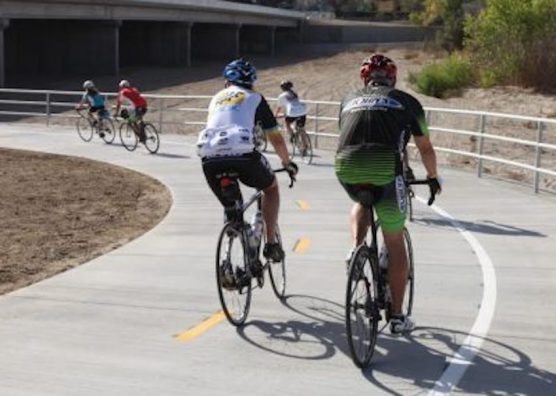
Local residents want Santa Clarita to have more biking and multi-use trails, safer routes and a variety of amenities for those who walk and bike around the community, according to feedback collected for the city’s 2020 non-motorized transportation plan.
In a virtual workshop last week, city officials shared a draft of the plan that is expected to go before the City Council this fall for consideration.
The plan, essentially an urban design concept that emphasizes streets for walking, biking and transit access to reduce reliance on private automobiles, was first adopted in 2008 and later updated in 2014 to include annexed areas. As required by the California Transportation Commission, the plan is updated every five years.
The latest draft, under a $150,000 contract with Los Angeles-based Alta Planning and Design to work on the changes, was more than just an update, according to Tom Reilly, trails and bikeways planning administrator with the city.
“We wanted more than just an update for the plan. We wanted to kind of tear down to the bare bones and rebuild it. Our thinking was that so much has changed over the last five to six years,” he said, referring to new bicycle technology and new funding sources now available, such as from Senate Bill 1, Measure M and other grants.
The feedback
Over the course of several months, the city received feedback from more than 800 residents through community surveys, pop-up events and stakeholder workshops.
Feedback revealed two key themes: safety and more facilities for biking and walking. Respondents said they would bike more if they felt safer on the roadway to get to and from bike paths. Responses were similar for those who walk in regards to crosswalks.
Survey takers also said that if the city could do three things to improve mobility citywide, they should prioritize having more bike and multi-use trails (60%), increasing connectivity between activity centers and neighborhoods (44%) and building more bike lanes (38%), followed by reducing delays on major highways, decreasing vehicle speeds on certain roads and constructing safer intersections.
Proposed recommendations
To help biking and walking feel safer, the draft plan recommends multiple, new shared-use paths and bridge under crossings to help people avoid high-stress corridors and access key destinations on low-stress facilities. For example, at Central Park, a shared-use path along the Bouquet Canyon Creek Channel would bring a safer and less trafficked path than what Bouquet Canyon Road currently offers.
A more connected network for those who bike and walk could be improved by closing critical gaps in the existing network so residents can best travel to and from community centers, transit hubs and workplaces, according to the report.
In Newhall, for example, the plan envisions a bicycle boulevard on Walnut Avenue, an extended South Fork Trail, extra bike parking in Old Town Newhall and adding a separated bikeway on Orchard Village Road, which would not remove any driving lanes but rather use the existing shoulder, said Reilly.
Active transportation is not adequately supported, based on the feedback and analysis collected. To make it easier, the plan proposes increasing support facilities such as bike parking, pedestrian-scale lighting, trail amenities and programs and policies to help foster a culture of biking and walking.
To see the complete draft, visit bikesantaclarita.com/masterplan.
Like this:
Like Loading...
Related


 Tweet This
 Facebook
 Digg This
 Bookmark
 Stumble
 RSS
RSS


REAL NAMES ONLY: All posters must use their real individual or business name. This applies equally to Twitter account holders who use a nickname.
0 Comments
You can be the first one to leave a comment.