|
|

|
|
|
[Sign Up Now] to Receive Our FREE Daily SCVTV-SCVNews Digest by E-Mail |
|
|
Inside Weather
Calendar 
Today in S.C.V. History May 7
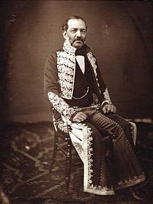
1861 - Andres Pico and partners granted state franchise to build toll road and cut 50-foot-deep cleft through (Newhall) Pass; they failed; Beale later succeeded [story]
|
Comment On This Story |
Opinion Section Policy
Read More From... RECENT COMMENTARY
Monday, May 6, 2024
Monday, May 6, 2024
Monday, May 6, 2024
Thursday, May 2, 2024
Thursday, May 2, 2024
Wednesday, May 1, 2024
|


 Tweet This
 Facebook
 Digg This
 Bookmark
 Stumble
 RSS
RSS


Latest Additions to SCVNews.com
|
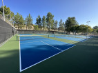
The city of Santa Clarita has announced the pickleball courts at Bouquet Canyon Park will be closed on Wednesday, May 8, for necessary maintenance on the windscreens.
 |
The California Animal Welfare Association, the San Francisco Society for the Prevention of Cruelty to Animals and the American Society for the Prevention of Cruelty to Animals have announced the inaugural California Adopt-a-Pet Day will take place on Saturday, June 1.
 |
1861 - Andres Pico and partners granted state franchise to build toll road and cut 50-foot-deep cleft through (Newhall) Pass; they failed; Beale later succeeded [story]
|
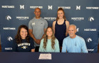
Gilbert, Arizona's Leah Burke has signed her National Letter of Intent to play soccer at The Master's University.
 |
CEDAR RAPIDS, Iowa - The Master's University struggled against a high-energy Georgetown (KY) Tigers squad, losing in straight sets 23-25, 18-25, 20-25 in the championship match of the 2024 National Association of Intercollegiate Athletics Men's Volleyball Championships.
 |
College of the Canyons student-athletes Nichole Muro (softball) and Owen Crockett (men's golf) have been named the COC Athletic Department's Women's and Men's Student-Athletes of the Week for the period running April 29 to May 4.
 |
|
Step into the Heart of 1970s Texas at The MAIN as Front Row Center presents, "Lone Star, Laundry, and Bourbon."
 |
Warmer weather, longer days and the sound of baseball is officially back!
 |
Mental Health Hookup, in partnership with Henry Mayo Newhall Hospital, will conduct the third annual Stop the Stigma community event on May 18, from 10 a.m. to 2 p.m., on the Henry Mayo Newhall Hospital campus, located at 23803 McBean Parkway in Valencia.
 |
California State University, Northridge is set to open a first of its kind resource center in the CSU system to provide basic needs services such as food, clothing and wellness in a centralized location on campus.
 |
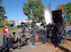
The city of Santa Clarita’s Film Office released the list of three productions currently filming in the Santa Clarita Valley for the week of Monday, May 6 - Sunday, May 12.
 |
In an effort to bolster local businesses, Los Angeles County just launched the Entertainment Business Interruption Fund, a $4.1 million grant program aimed to serve businesses that were impacted by the Hollywood strikes and the pandemic.
 |
|
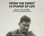
The city of Santa Clarita is excited to announce the upcoming exhibition, “From the Sweet Flypaper of Life,” featuring the remarkable works of high school students enrolled in the CalArts Community Arts Partnership (CAP) Photography Lab Program.
 |
Zonta Club of Santa Clarita Valley will host a free workshop to provide a recap of previous workshops beginning Nov. 18, 2023 through May 18, 2024 and a review of tools learned and how to continue to build on connected relationships.
 |
As a City dedicated to inclusivity and community, we aim to create world-class events to bring our residents together.
 |
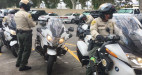
During Motorcycle Safety Awareness Month in May, the Los Angeles County Sheriff’s Department would like to remind drivers to always look twice for motorcycles.
 |
|
Dale Donohoe and Kim Kurowski were named the Santa Clarita Valley's top volunteers of the year at the 2024 SCV Man and Woman of the Year dinner celebration held Friday, May 3 at the Hyatt Regency Valencia. The event also honored all of the 17 men and 17 woman nominated for the award.
 |
|
|
|
The regular meeting of the Saugus Union School District Governing Board will take place Tuesday, May 7, with closed session beginning at 5:30 p.m., followed immediately by public session at 6:30 p.m.
 |
The city of Santa Clarita Arts Commission is holding its regular meeting in City Hall's Council Chambers Thursday, May 9 at 6 p.m. The meeting will be held at Santa Clarita City Hall, 23920 Valencia Blvd., Valencia, CA 91355.
 |
Experience the Butterfly Encounter at Gilchrist Farm open now on weekends thorugh Sunday, June 18. Walk through a tent of beautiful flowers hosting live butterflies that fly freely throughout the tent.
 |
The Santa Clarita Community College District Board of Trustees will hold a business meeting Wednesday, May 8, beginning at 5 p.m. The board will first meet in closed session at 4:15 p.m.
 |

REAL NAMES ONLY: All posters must use their real individual or business name. This applies equally to Twitter account holders who use a nickname.
4 Comments
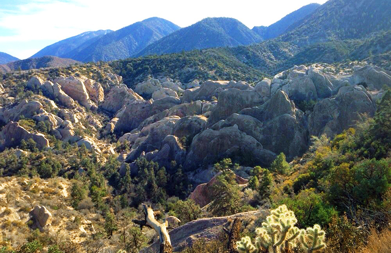
In March while sitting in the “devil’s chair” we took great photos of 4 bighorn sheep. Too bad I cant attach them to share. This is really an awesome place! Thanks for sharing.
I miss hiking around and picnics there!
Hiking with my Grandma in 1971…I need to go back! Thanks for the reminder!
You missed your calling – you should be on the National Geographic Film and Photo crew.
Awesome article. Awesome lady. Please write some more. Please !!!!