 The National Park Service was authorized by Congress, in the Consolidated Natural Resources Act of 2008, to conduct a special resource study.
The NPS has been working on this study ever since, which includes the mountains encircling the San Fernando, La Crescenta, Santa Clarita, Simi and Conejo valleys.
In past public meetings, the NPS has presented its preliminary findings and has received more than 5,000 comments from the public. It will once again present its findings to the public in late February or early March.
This will be your last opportunity to have your voice heard before the final recommendations are made to Congress.
The purpose of the study is to determine if any portion of the study area would be eligible to be designated as a unit of the National Park system, or become a part of an existing National Park unit. NPS will also consider ways to partner with private and governmental entities to try to protect resources and provide more outdoor recreation opportunities. The NPS will work collaboratively with existing agencies.
 In the public meetings that we have had with National Park Service representatives, they have presented their preliminary findings and offered multiple alternative concepts for public consideration. These concepts range from large-scale protections throughout the range of the study, to “do nothing.”
All of these concepts are available online if you wish to read them. They are far too lengthy to include here, so I hope you will go to the following web site and read them so you are fully informed: http://www.nps.gov/pwro/rimofthevalley.
It is possible the NPS can acquire land within the study boundaries after legislation, but only from willing sellers. There will be no imminent domain. The NPS will not have authority over private land.
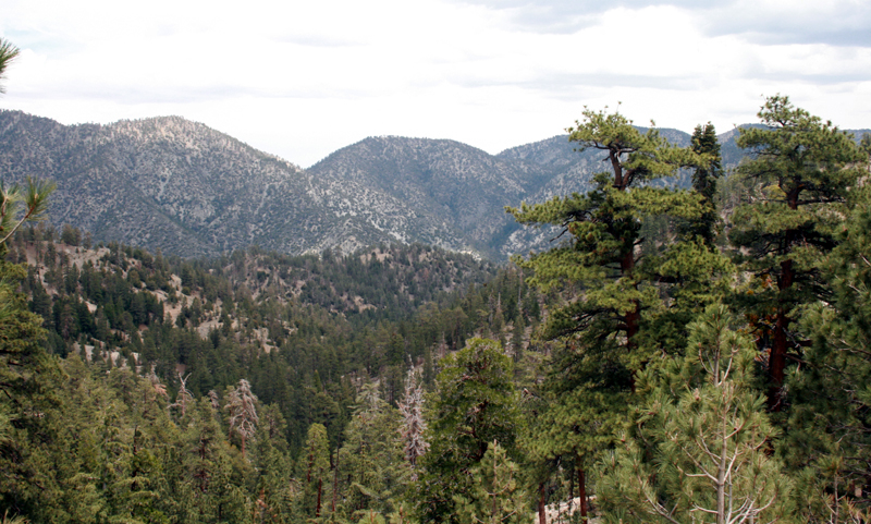
Recently, portions of the Angeles National Forest were declared a national monument by President Obama. The area of the forest that abuts Santa Clarita was left out of the national monument with no explanation. This area, however, is within the boundary of the Rim of the Valley study, and it has been mentioned in the study’s previous release in that the NPS would like to see the Soledad corridor protected. (Note: The high-speed rail will be roaring through this important wildlife linkage.) It is my hope that the Rim of the Valley Corridor study will end up protecting this wildlife crossing, which is the only area for migration from the Sierra Pelona to the San Gabriel Mountains.
 The other problem in this corridor is Cemex, which is right in the most important wildlife crossing area – the area that connects the upper non-contiguous Angeles National Forest and the Sierra Pelona to the Angeles National Forest, and most importantly to the Magic Mountain wilderness.
In the last round of public comments, the majority of people asked that the NPS combine alternatives C and D which, would connect urban parks to natural habitat. This would also provide the most protection for both natural and historical resources.
It was also overwhelmingly popular that the NPS should maintain a role in the operations of the Rim of the Valley corridor. The reason is that the NPS is better funded than are the national forests. National Forest Service funds are almost entirely directed to fire fighting. The NPS also has the talent – biologists, botanists, archeologists, historians, roving rangers, educators, etc. – needed to make a project such as this as great success.
 Alternative C was highly supported because people liked the concept of having the NPS in the San Fernando Valley and Los Angeles because these areas are generally park-poor communities. This alternative offered the possibility of interconnected parks and natural areas within the county. People liked the idea that both the Arroyo Seco and the Los Angeles rivers were included.
Environmental justice issues were also of great concern in these urban areas, and people felt the NPS could address this by connectivity between the urban and natural habitats. Many people supported this alternative if it included their immediate locations: the Verdugo Mountains, Hansen Dam-Tujunga Wash, Sepulveda basin, Los Encinos State Historic Park, Griffith Park, etc.
This alternative is a great way to expand recreation in and around many local areas, and it would bring about great partnerships with local agencies. There are also many possibilities of creating greenways, bike paths, hiking trails and equestrian trails that would lead into the forests from neighborhoods and urban parks.
Alternative D was supported by almost everyone who commented to the NPS. It was highly supported because it offered the most protection of the last remaining natural habitat in Southern California. It provided the best chance of the survival of all species within the region, and opportunities for environmental education. This alternative also provided partnerships in protecting wildlife corridors (such as the Soledad corridor mentioned above).
We have asked the NPS to take the Santa Clarita Valley, the Santa Clara River, the Santa Clara River (Soledad) corridor, and the Santa Clara River watershed under consideration for protection. We have also asked that the NPS work with the city of Santa Clarita to help reconnect the two divided areas of the Angeles National Forest.
We would love to see a presence of the NPS in Santa Clarita. Please stay tuned for more information as it becomes available, and for information on any and all upcoming meetings. I encourage you to attend all meetings to have your voice heard.
Dianne Erskine-Hellrigel is executive director of the Community Hiking Club and president of the Santa Clara River Watershed Conservancy. If you’d like to be part of the solution, join the Community Hiking Club’s Stewardship Committee. Contact Dianne through communityhikingclub.org or at zuliebear@aol.com.

Like this:
Like Loading...
Related



 Tweet This
 Facebook
 Digg This
 Bookmark
 Stumble
 RSS
RSS









REAL NAMES ONLY: All posters must use their real individual or business name. This applies equally to Twitter account holders who use a nickname.
4 Comments
Snowflower!
It’s important to note that there are few if any comments regarding the takeover of current NFS land by agencies that would limit if not remove vehicular access that currently exists. The Angeles National Forest currently has blocked many roads into the areas adjacent to the SCV due to “damage caused by the Station Fire”. Please check the ANFS website for further information.
Many miles of these roads are blocked by locked gates, not because they provide access to areas actually burned by the Station Fire, but because they lead to areas near the burn area where no other gates exist. The ANFS says it cannot monitor access, nor limit access near the burn areas because they don’t have gates in the fire area, nor can they provide rangers to monitor area usage. They therefore lock the gates at the nearest access point, for instance the Santa Clara Truck Trail on the west, and the Aliso Canyon Truck trail on the east. In addition, due to budget constraints, they do not have enough rangers to provide monitoring, nor do they have the funds to repair and improve roads that were damaged after the fire by rain and flooding. This is reported to be so, even though they have graded and plowed a number of these roads. They can, however, allow mining interests to have full and unimpeded access throughout these areas.
Whether you agree that another agency should take control or not, the current state of affairs seems to be that these areas that are required by law to be open to use by all of us are not.
It seems to me that their current method of protecting the National Forest for us has been determined to be that it be protected from us.
If you believe that we should all have access to the ANFS, then you should weigh in and speak up. If we all don’t tell them to let us in, we’re telling them it’s OK to keep us out.
@jimvs: I agree wholeheartedly that we should all have access to the ANFS.
And actually we do all have access to the Angeles National Forest. Our vehicles, however, do not have access. There is no prohibition on entering the forest via the Santa Clara Truck Trail on a bicycle or on foot — Ms. Erskine-Hellrigel and a number of volunteers rebuilt a trail from a trailhead several miles into the forest using equipment brought in on bicycles or by wheelbarrow since they could not access the trailhead with vehicles. I’ve hiked/run the road from Sand Canyon to Indian Canyon to Soledad several times and there is indeed quite a bit of damage from the Station fire still present on and near the road.
Frankly I’m quite happy not to have to dodge vehicles on that road or to encounter loads of trash tossed out by people who drove into the national forest to party on public land as we used to see when the SCTT was open to vehicles. Not just piles of beer cans and smashed bottles, but also mattresses, chairs, and ice chests, and we’d frequently find evidence of open campfires dangerously close to brush.
I’d also worry that if vehicles were able to get on those roads we would likely see even more pot cultivation in the national forest than we already do, using what scarce water there is up there and dumping fertiliser and other agricultural chemicals without a care for the forest.
There is a significant disconnect between what I believe “open access to all” means, and what you’ve stated in your reply. I am happy that you have the health and vigor to hike the roads in the Angeles. I used to be able to do that as well. I also used to be able to drive further into the ANF and park so that with my physical abilities diminished due to age and infirmities I could still gain access to the biological, historical, geographic and geological wonders it contains.
Not so much anymore.
In essence you are declaring for unequal access, for families with three small children being excluded (since each adult can only carry one). And for seniors unlucky enough to not have the health, stamina, and strength of yourself being excluded from access. And for young people with physical condtions that prevent miles of hiking in seriously up-and-down country being excluded.
Maybe you should be required to pay extra for your unequal access to and use of areas that were purposely set aside from being claimed under the homestead acts as lands that were for all the people to use and enjoy.