|
|

|
|
|
[Sign Up Now] to Receive Our FREE Daily SCVTV-SCVNews Digest by E-Mail |
|
|
Inside Weather
Calendar 
Today in S.C.V. History July 26
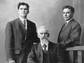
1870 - Armantha Thibaudeau, community leader during early 20th Century and co-founder of chamber of commerce, born in Kentucky [story]

|
Comment On This Story |
SCV NewsBreak LOCAL NEWS HEADLINES
Friday, Jul 26, 2024
Friday, Jul 26, 2024
Friday, Jul 26, 2024
Keep Up With Our Facebook
|


 Tweet This
 Facebook
 Digg This
 Bookmark
 Stumble
 RSS
RSS


|
Latest Additions to SCVNews.com
|


REAL NAMES ONLY: All posters must use their real individual or business name. This applies equally to Twitter account holders who use a nickname.
0 Comments
You can be the first one to leave a comment.