|
|

|
|
|
[Sign Up Now] to Receive Our FREE Daily SCVTV-SCVNews Digest by E-Mail |
|
|
Inside Weather
Calendar 
Today in S.C.V. History December 26
1873 - Vasquez gang raids Kingston in (now) Kings County; ties up townspeople, makes off with $2,500 in cash and jewels [story]
|
Comment On This Story |
Opinion Section Policy
Read More From... RECENT COMMENTARY
Friday, Dec 19, 2025
Wednesday, Dec 10, 2025
Wednesday, Dec 3, 2025
Tuesday, Dec 2, 2025
Tuesday, Dec 2, 2025
Wednesday, Nov 26, 2025
|


 Tweet This
 Facebook
 Digg This
 Bookmark
 Stumble
 RSS
RSS


Latest Additions to SCVNews.com
|
The California Highway Patrol is highlighting new public safety laws passed during this year’s legislative session and signed by Governor Gavin Newsom that, unless otherwise stated, take effect Thursday, Jan. 1, 2026.
 |
Kaiser Permanente has awarded a $12,000 Community Health Grant to Bridge to Home to help address homelessness in the Santa Clarita Valley.
 |
Boys and girls Foothill League soccer teams have been on holiday schedule this past week, with some teams taking time off and others playing non-league matches. Consequently, league standings haven’t changed much.
 |
College of the Canyons women's basketball notched another mark in the win column, as the Cougars were able to stack a second straight road victory 54-46 at Oxnard College on Wednesday, Dec. 17.
 |
1873 - Vasquez gang raids Kingston in (now) Kings County; ties up townspeople, makes off with $2,500 in cash and jewels [story]
|
The Santa Clarita Valley Sheriff's Station has issued the following traffic alerts: Due to heavy rains, the westbound right lane is closed on Soledad Canyon Road between Camp Plenty Road and Langside Avenue.
 |
|
Fostering Youth Independence’s recent Charlie Brown Holiday party was attended by dozens of local foster youth and their volunteer Allies.
 |
The National Weather Service as issued the following alerts for the Santa Clarita Valley. Flood Watch until Dec. 26, 4 p.m. PST, High Wind Warning until Dec. 25, 3 p.m. PST.
 |
|
Los Angeles County Supervisor Kathryn Barger is urging residents to remain vigilant as a powerful storm system moves through Los Angeles County, bringing periods of heavy rain and rapidly changing conditions.
 |
Thirteen suspects were arrested, and more than $800,000 in stolen merchandise was recovered following a coordinated, multi-agency operation targeting an organized retail theft network operating across Northern California.
 |
The California State Transportation Agency today announced a new joint effort by two of its departments, the Department of Motor Vehicles and California Highway Patrol, to curb excessive speeding and prevent deadly crashes.
 |
|
The city of Santa Clarita invites the community to heat up the holiday season at the Holiday Spice Salsa Edition on Saturday, Dec. 27, at the Canyon Country Community Center, located at 18410 Sierra Highway Santa Clarita, CA 91351.
 |
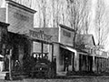
1965 - Signal newspaper owner Scott Newhall shows up for a duel (of words) with rival Canyon Country newspaper publisher Art Evans, who no-shows and folds his paper soon after [story]

|
As winter storms enter Los Angeles County, the Los Angeles County Department of Animal Care and Control urges pet owners to take necessary precautions in light of the significant storms expected to last for five days.
 |
Brayden Miner scored 31 points and Rylan Starr had 24 as The Master's University men's basketball team crushed Bethesda University 145-59 The MacArthur Center.
 |
From surprise Santa arrivals to stacks of gifts waiting for young hands, the Boys & Girls Club of Santa Clarita Valley delivered holiday cheer on a large scale this season, reaching hundreds of children and teens throughout the Santa Clarita Valley, including Clubhouses in Canyon Country, Newhall, Val Verde and Castaic.
 |
Princess Cruises, headquartered in Santa Clarita, embraced a cherished maritime tradition in a uniquely festive way, celebrating a symbolic christening of its Rose Parade float with a ceremonial break of a bottle of Pantalones Organic Tequila.
 |
|
The Golden Globes have ushered in awards season with the announcement of the 2026 nominees across 28 categories. Among this year’s contenders is Pixar’s "Elio," which earned a nomination for Best Motion Picture – Animated.
 |
The National Weather Service has issued a "Hazardous Weather" warning for the Santa Clarita Valley and Southern California.
 |
Detectives from the Los Angeles County Sheriff’s Department Missing Persons Unit are asking for the public’s help locating at-Risk missing person Drew Barrick Russell.
 |
1997 - Five bodies found during grading of Northlake development in Castaic; determined to be Jenkins graveyard [story]

|
Old Town Newhall Public Library will host "Spice Travels," Friday, Jan. 2, 9:15-9:30 a.m. at 24500 Main St., Santa Clarita, CA 91321.
 |

REAL NAMES ONLY: All posters must use their real individual or business name. This applies equally to Twitter account holders who use a nickname.
4 Comments
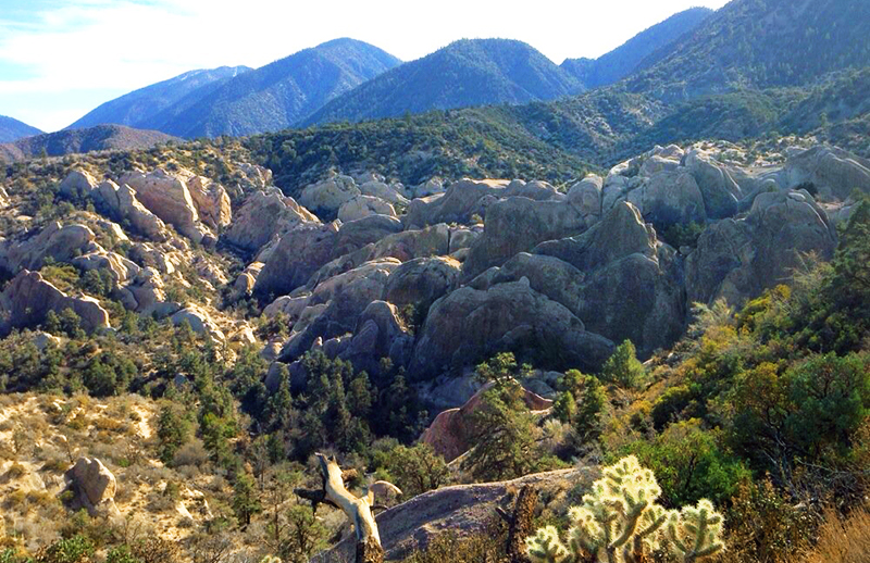
In March while sitting in the “devil’s chair” we took great photos of 4 bighorn sheep. Too bad I cant attach them to share. This is really an awesome place! Thanks for sharing.
I miss hiking around and picnics there!
Hiking with my Grandma in 1971…I need to go back! Thanks for the reminder!
You missed your calling – you should be on the National Geographic Film and Photo crew.
Awesome article. Awesome lady. Please write some more. Please !!!!