header image

[Sign Up Now] to Receive Our FREE Daily SCVTV-SCVNews Digest by E-Mail

Inside
Weather


Calendar
Today in
S.C.V. History
December 23
1997 - Five bodies found during grading of Northlake development in Castaic; determined to be Jenkins graveyard [story]
reburial


Commentary by Mike Summe
| Thursday, Oct 27, 2016

mikesummeWhen I moved to California in 1977, I settled in the flatlands of the L.A. basin and stayed there for the next 35 years, paying scant attention to the mountains. In 2012, I retired and started hiking and biking into the mountains that separate my home in Shadow Hills from Santa Clarita. I kept running into strange, fenced-in sites, usually located at the top of cul-de-sacs.

Each site consisted of a pit that ended at a concrete wall. Close to the wall, a strange perforated silo would rise up. On the locked gates hung two signs. One warned against trespassing. The other declared the site was under the control of the Los Angeles County Department of Public Works and gave what appeared to be the name of the site — often the name of the street followed by the abbreviation “D.B.”

It turned out that “D.B.” means “debris basin.” There are 172 in Los Angeles County, including 33 in the Santa Clarita Valley. My purpose here is to share some basic facts about these important structures and give you some leads if you’d like to do some exploration of your own.

What is a debris basin? One website (www.fws.gov) defines a debris basin as a “specially engineered and constructed basin for storing large amounts of sediment moving in an ephemeral stream channel.” The DPW provides a more helpful definition: “Debris basins are instrumental components of the flood control system. Typically located at the mouths of canyons, debris basins capture the sediment, gravel, boulders, and vegetative debris that are washed out of the canyons during storms. The debris basins capture the material and allow the water to flow into the downstream storm drain system.”

debrisbasin02Each debris basin typically consists of an excavation that begins at the bottom of a canyon and terminates at a dam. Near the dam is a “perforated silo” made of corrugated metal, sometimes concrete. The DPW calls these silos “the outlet works.” Their purpose is to allow the water to flow past (under) the dam, even when a considerable amount of debris has accumulated in the basin. The paved spillway on the downhill side of the dam helps control the water that flows under or, on occasion, over the dam.

The debris basins may also contain a number of less visible features including a porous basin that allows water to soak into the ground and a well that stores water that can later be pumped into the public water supply. In the hills above the debris basins, one may find check dams and other structures that direct water into the canyon.

Not all debris basins have all of these features; the oldest ones didn’t separate the water from the debris. As for size, most debris basins “are associated with small catchments and … are commensurately modest, with capacities under 100,000 cubic yards.” The smallest one I’ve seen is the Camp Plenty debris basin in Canyon Country; a larger, more complete one is the Wedgewood debris basin in Castaic.

What is the purpose of debris basins? The answer is best explained as the interaction of two inexorable forces. The first is the geology of Los Angeles. The mountains that dominate our landscape are among the youngest and most rapidly rising on Earth and the most unstable. As John McPhee points out in his well-known essay, “Los Angeles Against the Mountains,” the San Gabriel Mountains are “shedding, spalling” and “disintegrating at a rate that is … among the fastest in the world.” The second inexorable force is people. Los Angeles County has a population of more than 10 million, and we all know that more and more houses are being built in the mountains and foothills. There are plenty of recent examples in the Santa Clarita Valley.

What happens when these two forces interact is explained by the DPW: “Although the weather in Southern California has often been described as the best to be found anywhere, it is capricious and capable of producing enormous flood devastation. Storms, moving in from the Pacific generally from October to March, come up against the numerous steep mountain ranges that ring Malibu, the Los Angeles Basin, and the Antelope, San Fernando, San Gabriel and Santa Clarita Valleys. These storms frequently produce enormous amounts of runoff that spill out onto the flatlands leading to the Pacific Ocean or Mojave Desert. And if the age-old fire sequence has occurred along the hillsides during the dry months, the rate, composition and amount of runoff are substantially increased. Since the geological composition of the mountain ranges erodes quite easily, a heavy mix of debris is added to the descending storm waters.”

John McPhee gives a vivid description of what the DPW calls “a heavy mix of debris.” Debris flows, McPhee explains, “more or less resemble fresh concrete. They consist of water mixed with a good deal of solid material, most of which is above sand size. Some of it is Chevrolet size.” His automotive metaphor is not inappropriate, for in his description of a specific event, he tells how a mudslide “was not only full of boulders; it was so full of automobiles it was like bread dough mixed with raisins.” Making matters worse, the mudslide was fast enough to overtake a number of residents who tried to flee downhill in their cars.

How effective are the debris basins? Although man cannot control the mountains of Los Angeles, John McPhee admits: “Generally, the debris basins work.” But they are not 100 percent effective, and debris basins can and have been overwhelmed – sometimes with catastrophic results. Also, debris basins are expensive – not only to build, but also to maintain.

debrisbasin01To function properly, the debris must regularly be cleaned out, which not only requires expensive contracts, but also raises the question of where the debris goes. It is easiest if the site is nearby, but you probably won’t be surprised to learn this is not always popular with residents. Sometimes the debris, which in the absence of man’s intervention would have washed down to the ocean, is hauled in the opposite direction over the mountains. McPhee explains the irony: “Now there is a beach problem. Sand is being lost to offshore canyons and is not being replenished. … A place that values its beaches as much as Southern California does has no choice but to buy sand.” And people can be picky. “When 30,000 yards of sand was put on Zuma Beach, people complained that it was the wrong color.”

A short history. In the early days, “there was a moat of oranges between the built-up metropolis and the mountain front.” However, when wildfires in late 1913 were followed by heavy rains and a flood in early 1914, it was clear that more protection was needed. The government responded quickly. In 1915, the California Legislature created the Los Angeles County Flood Control District. One of its first projects was the Devil’s Gate Dam, built in 1920 to control the Arroyo Seco. A few years later, nature again delivered its one-two combination. At the end of 1933, wildfires denuded the slopes above Pasadena, La Cañada, La Crescenta and Montrose. Then on New Year’s Day, a “Noah-type storm” struck, mobilizing “a number of almost simultaneous debris flows that came out of the mountains, went through the orchards and into the towns, killed dozens of people, destroyed hundreds of houses, and left boulders the size of icebergs.”

There was ironically an unexpected benefit to this disaster. People noticed that a gravel pit in Haines Canyon above the village of Tujunga had swallowed the debris flow that would otherwise have wiped out the community. According to McPhee, this gravel pit became the inspiration, the model for all debris basins.

Be that as it may, a number of debris basins were built on the southern slopes of the San Gabriels in the aftermath of the 1934 mudslides. On a website maintained by the U.S. Geological Survey, I found the dates of initial operation for 75 of Los Angeles County’s 172 debris basins. Fifteen were built in the immediate aftermath of the 1934 flood, all in the area of that flood. Seven more were built in the 1940s; again, most were built on the south-facing slopes of the San Gabriels in the greater Pasadena area, but one was built as far west as Northridge and another as far east as Brea. Nineteen were built in the 1950s, with most on the south-facing slopes above Foothill Boulevard, but with one in Whittier, one in the Verdugos and a few in the San Fernando Valley. Twenty were added in the 1960s, some in the core area but others extending out to Glendora and one in Newhall — the Wildwood debris basin on Davey Avenue. The USGS website identified 12 debris basins built between 1970 and 1975; however, there was no information for subsequent years, so I do not have operation start dates for the other 97 debris basins.

My guess is that the 97 undated debris basins were built after 1975. Why do I say this? Because the information I do have suggests the building of debris basins occurred in step with the development of housing tracts in or near the mountains. My sense is that the earliest residential development occurred in the greater Pasadena area where the earliest debris basins are located. It also seems that the order in which additional debris basins radiated from Pasadena between 1940 and 1975 follows the same timeline as residential expansion. Many of the undated debris basins are located in areas where large-scale building occurred still later.

To the east, the communities with debris basins for which I have no dates include Monrovia, Duarte, Glendora, Rowland Heights, Diamond Bar; to the west, Canoga Park, Calabasas, Malibu; and to the north, Santa Clarita, Castaic and Palmdale.

As part of my research, I visited five debris basins in the hills along Hillcrest Parkway in Castaic. The neighborhoods are obviously newly built, and at the end of the cul-de-sacs that mark the uphill limit of development, I found the debris basins. My conclusion? They were built contemporaneously with the housing tracts. Am I right? I won’t know for sure until I find the start dates. If anyone can provide me with such dates or point me in the right direction, please send me the information.


Mike Summe is a docent at the Placerita Canyon Nature Center and a retired high school principal.

Comment On This Story
COMMENT POLICY: We welcome comments from individuals and businesses. All comments are moderated. Comments are subject to rejection if they are vulgar, combative, or in poor taste.
REAL NAMES ONLY: All posters must use their real individual or business name. This applies equally to Twitter account holders who use a nickname.

4 Comments

  1. Very interesting Mike. Thanks.

  2. Julio Diaz says:

    Fantastic read, thank you Mike :)

  3. Great, Mike. Tried to share this in Placerita fb page, failed.

  4. Tina White says:

    I talk about these in the college geography courses I teach; thank you for an interesting new assigned reading for my students!

Leave a Comment


Opinion Section Policy
All opinions and ideas are welcome. Factually inaccurate, libelous, defamatory, profane or hateful statements are not. Your words must be your own. All commentary is subject to editing for legibility. There is no length limit, but the shorter, the better the odds of people reading it. "Local" SCV-related topics are preferred. Send commentary to: LETTERS (at) SCVNEWS.COM. Author's full name, community name, phone number and e-mail address are required. Phone numbers and e-mail addresses are not published except at author's request. Acknowledgment of submission does not guarantee publication.
Read More From...
RECENT COMMENTARY
Friday, Dec 19, 2025
There's no better way to celebrate the season than with toys, treats, and rollercoasters. My annual Foster Youth Holiday Party is one of the most special traditions we do each year
Wednesday, Dec 10, 2025
I'm overjoyed to share that as of this week, several Altadena residents have moved back into their newly-rebuilt homes in time for the holidays.
Wednesday, Dec 3, 2025
As we wrap up this incredible year with JCI Santa Clarita, my heart is truly overflowing with gratitude. This chapter has shown up in such wonderful ways, and I’m so proud of everything we’ve created together.
Tuesday, Dec 2, 2025
It’s hard to believe that our city will turn 38-years-old as of Monday, Dec. 15.
Tuesday, Dec 2, 2025
As we wrap up another year, I find myself reflecting on how extraordinary and eventful 2025 has been for our city.
Wednesday, Nov 26, 2025
Today, my team and I set out to four different sites across the Fifth District for our 8th Annual Day of Giving.

Latest Additions to SCVNews.com
As winter storms enter Los Angeles County, the Los Angeles County Department of Animal Care and Control urges pet owners to take necessary precautions in light of the significant storms expected to last for five days.
DACC Urges Pet Owners to Prioritize Safety Ahead of Storm
Brayden Miner scored 31 points and Rylan Starr had 24 as The Master's University men's basketball team crushed Bethesda University 145-59 The MacArthur Center.
Season’s Best Offensive Performance Leads TMU Over Bethesda
From surprise Santa arrivals to stacks of gifts waiting for young hands, the Boys & Girls Club of Santa Clarita Valley delivered holiday cheer on a large scale this season, reaching hundreds of children and teens throughout the Santa Clarita Valley, including Clubhouses in Canyon Country, Newhall, Val Verde and Castaic.
Boys & Girls Club of Santa Clarita Valley Spreads Holiday Cheer
Princess Cruises, headquartered in Santa Clarita, embraced a cherished maritime tradition in a uniquely festive way, celebrating a symbolic christening of its Rose Parade float with a ceremonial break of a bottle of Pantalones Organic Tequila.
Princess Cruises Christens Star Princess Tournament of Roses Float
The Golden Globes have ushered in awards season with the announcement of the 2026 nominees across 28 categories. Among this year’s contenders is Pixar’s "Elio," which earned a nomination for Best Motion Picture – Animated.
CalArtian-Directed ‘Elio’ Nominated for 2026 Golden Globe
The National Weather Service has issued a "Hazardous Weather" warning for the Santa Clarita Valley and Southern California.
NWS Issues Flood, High Wind Warnings for SCV, Southland
Detectives from the Los Angeles County Sheriff’s Department Missing Persons Unit are asking for the public’s help locating at-Risk missing person Drew Barrick Russell.
LASD Asks for Help Locating Missing Santa Clarita Man
1997 - Five bodies found during grading of Northlake development in Castaic; determined to be Jenkins graveyard [story]
reburial
Old Town Newhall Public Library will host "Spice Travels," Friday, Jan. 2, 9:15-9:30 a.m. at 24500 Main St., Santa Clarita, CA 91321.
Jan. 2: Explore Global Cuisine with ‘Spice Travels ‘ at Newhall Library
The California Highway Patrol encourages the public to “brake” the habit of speeding this holiday season. The CHP will launch a Holiday Enforcement Period starting at 6:01 p.m. on Wednesday, Dec. 24, and ending at 11:59 p.m. on Thursday, Dec. 25.
Dec. 24-25: CHP Launches Holiday Enforcement Period
Volunteers are needed to help clear brush and restore the tread from the existing lower Gates and Twister trails 8 a.m.-noon Saturday, Dec. 27.
Dec. 27: Volunteers Needed for SCV Trail Users Workday
Join InfluenceHER's "Redefining Happiness, a Candid Conversation for the Modern Woman," 4-6 p.m., Friday, Jan. 16 at the Venue Valencia.
Jan. 16: InfluenceHER- Redefining Happiness, A Candid Conversation for the Modern Woman
The Santa Clarita Public Library system has announced that all library branches will close at 1 p.m. on Christmas Eve, Wednesday, Dec. 24, and remain closed on Christmas Day, Thursday, Dec. 25, in observance of Christmas.
Santa Clarita Public Library Holiday Hours
Students pursuing an undergraduate degree in water resource-related fields are invited to apply for the 2026/27 ACWA Edward G. “Jerry” Gladbach Scholarship, offered by the Association of California Water Agencies in partnership with SCV Water. Applications are now being accepted through March 1, 2026.
SCV Water Announces 2026/27 ACWA Edward G. ‘Jerry’ Gladbach Scholarship
Chloe Auble scored a career-high 40 points and Allie Miller came a rebound away from her first career triple-double as The Master's University Women's Basketball team defeated the Bethesda Lion Angels 125-24 in the MacArthur Center.
Lady Mustangs Break Scoring Records in Win
Vallarta Food Enterprises, headquartered in Santa Clarita, has been ordered by a federal court to comply with subpoenas relating to charges of employment discrimination.
Federal Court Orders Vallarta to Comply with EEOC Subpoenas
Burrtec Waste Industries has partnered with the city of Santa Clarita to establish three convenient locations for residents to recycle real holiday trees this season.
Dec. 26-Jan. 10: Recycle Trees, Wreaths at City Drop-Off Locations
The North American Aerospace Defense Command is ready to track Santa on Wednesday, Dec. 24, Christmas Eve, and is celebrating the program’s 70th anniversary.
NORAD Santa Tracker Celebrates 70th Anniversary
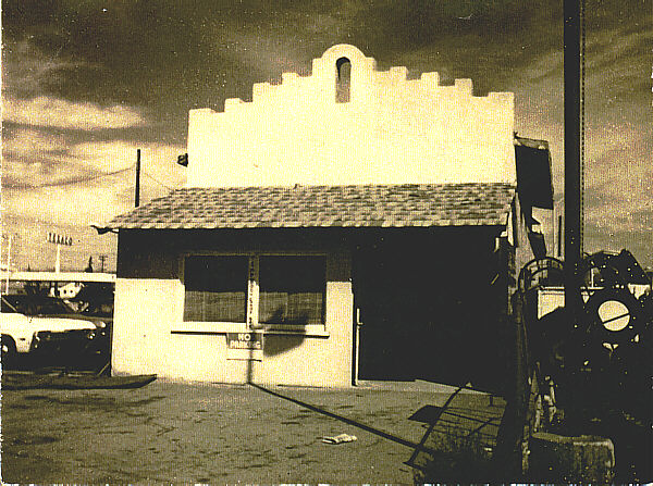
1905 - County buys property to build Newhall Jail (now next to city's Old Town Newhall Library) [story]
Old Newhall Jail
The weather might not be "frightful" yet, but Santa Clarita Valley residents may experience a soggy and cold Christmas Day this year. Rain is expected in the SCV beginning Tuesday, Dec. 23 in the evening and continuing into Friday, Dec. 26
Dec. 22: Burn Ban Day for SCV, Rains Start Dec. 23
1910 - Newhall (Auto) Tunnel opens, bypassing Beale's Cut [story]
Newhall Tunnel
1892 - Benjamin Harrison establishes 555,520-acre San Gabriel Timberland Reserve (Angeles National Forest). First forest reserve in California, second in U.S. [story]
map
SCVNews.com